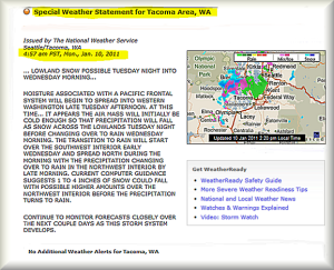
Severe Weather and Possible Snow?
There is snow in the forecast for later in the day on Tuesday, and it could begin falling
during the afternoon commute.
That situation could create very different morning and afternoon travel conditions for bus riders.
Transit users are advised to plan ahead for afternoon and evening trips that could be disrupted,
delayed, reduced, or on snow routing.
Even though weather in the morning may be clear, leave from a bus stop or park-and-ride that also
has service when buses are on snow routes in case travel conditions deteriorate by the afternoon commute.
Give yourself extra time to reach your evening destination. Busescould be crowded in the early part
of the afternoon commute if everyone tries to get home before snowfall is the heaviest.
Metro is urging bus riders to prepare by visiting Metro Online and knowing the snow routing for the
buses they will ride tomorrow.
Then, before traveling, riders should check for the most current status of Metro service. Updates to
online information begin as early as 4 a.m. and continue as needed until the storm is over.
A Tuesday snowfall could create challenges for all vehicles, especially if the snow begins to fall during
the afternoon commute. Bus operations could change rapidly.
Here are some tips for bus travel if it does snow:
• Know the snow routing for your bus route. Check timetables for snow route maps for each route. Not
every bus route has snow routing, but most do;
• When buses are on snow routing, some streets and bus stops may be missed and there are often
delays due to travel conditions. There is new snow routing in many areas that is different from past
years, so be sure to check the snow routes for the routes you use most often or are likely to use
during snow;
• Metro uses an online color-coded map to keep riders advised of the status of its bus service. All bus
routes are assigned into one or more of seven King County geographic areas. When there is snow or
ice on the roads, the color-coded service status of each area is displayed map. Green indicates buses
are operating on normal routes; yellow that some – but not all – routes in the area are on snow routes, and
red tells you that all bus routes in the entire geographic area are on snow routing;
• People without online access can call the Customer Information Office at (206) 553-3000. General
information about service is also sent via the kcmetrobus Twitter account;
• Be patient. Buses are not always on schedule in snowy or icy conditions. And, increased ridership
during bad weather can result in crowded buses and a longer-than-usual wait on the phone for the
Customer Information Office;
• Dress warmly, wear appropriate footwear for the weather…and expect delays;
• Use bus stops on flat portions of main arterials or at major transfer points such as park-and-ride lots,
transit centers, or shopping centers.
Thanks for riding and for using Metro’s services.
Travel safely.


